


 Collection of 30 maps of Indonesia, engavings and lithographs, 18th and 19th century (30)
...")
 Collection of 30 maps of Indonesia, engavings and lithographs, 18th and 19th century (30)
...")
 Collection of 30 maps of Indonesia, engavings and lithographs, 18th and 19th century (30)
...")
 Collection of 30 maps of Indonesia, engavings and lithographs, 18th and 19th century (30)
...")
 Collection of 30 maps of Indonesia, engavings and lithographs, 18th and 19th century (30)
...")
 Collection of 30 maps of Indonesia, engavings and lithographs, 18th and 19th century (30)
...")
 Collection of 30 maps of Indonesia, engavings and lithographs, 18th and 19th century (30)
...")
 Collection of 30 maps of Indonesia, engavings and lithographs, 18th and 19th century (30)
...")
Lot 177
Indonesia.- Various cartographers (18th and 19th century) Collection of 30 maps of Indonesia, engavings and lithographs, 18th and 19th century (30)
Hammer Price: £3,000
Description
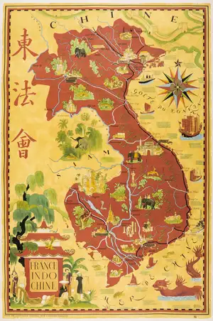
Indonesia.- Various cartographers (mainly 18th and 19th century) Collection of 30 maps of Indonesia, many rare and unrecorded at auction, with detailed maps of Sumatra, Sulawesi, the Malacca Strait, Java, including the Passaroeng Residence, the Gulf of Tomini, Maluku, and other locations outside Indonesia including Southern Borneo, by cartographers and publishers that include R. Everwin, Topographical Bureau of Batavia, F.G. Steck, Le Baron P. Melvill, C.F. Stefler, others by 19th century Dutch cartographers, engravings, lithographs, some with hand-colouring, various sizes, largest approx. 720 x 540 mm (28 1/4 x 21 1/4 in), old folds to some, a few carefully repaired splits, occasional minor handling creases, all unframed, 18th and 19th century (30)
⁂ A unique opportunity to acquire a comprehensive collection of scarce maps covering Indonesia and Borneo, many without auction precedent.
Description
Indonesia.- Various cartographers (mainly 18th and 19th century) Collection of 30 maps of Indonesia, many rare and unrecorded at auction, with detailed maps of Sumatra, Sulawesi, the Malacca Strait, Java, including the Passaroeng Residence, the Gulf of Tomini, Maluku, and other locations outside Indonesia including Southern Borneo, by cartographers and publishers that include R. Everwin, Topographical Bureau of Batavia, F.G. Steck, Le Baron P. Melvill, C.F. Stefler, others by 19th century Dutch cartographers, engravings, lithographs, some with hand-colouring, various sizes, largest approx. 720 x 540 mm (28 1/4 x 21 1/4 in), old folds to some, a few carefully repaired splits, occasional minor handling creases, all unframed, 18th and 19th century (30)
⁂ A unique opportunity to acquire a comprehensive collection of scarce maps covering Indonesia and Borneo, many without auction precedent.
Related Lots
Back To Auction Catalogue

 Newsletter Signup
Keyword Alerts
You can now save your preferences to receive emails, or create a free lite account which gives you more features.
Would you like to receive personalised keyword alerts when new catalogues go live. If so, please indicate these below
Set a password to save your keyword alerts
Passwords are a minimum of 7 characters and must include an upper case letter, a lower case letter, a number and a special character.